We are very proud to open our web interface The Ocean Bulletin to all users, enabling them to optimize several port-to-port routes in the Mediterranean Sea. This interface makes it easy to visualize weather and ocean conditions along your route, based on your departure time and average vessel speed. In addition to wind and wave forecast information, derived from the best meteorological model for this zone (ICON-Europe), the interface calculates the impact of ocean currents along the chosen route, thanks to our high-resolution (1/30°) HIRES-CURRENTS forecasts. The cutting-edge technology developed by Amphitrite fuses multiple satellite observations, using artificial intelligence, to provide a new generation of highly reliable and accurate ocean data to make the right decisions at sea.
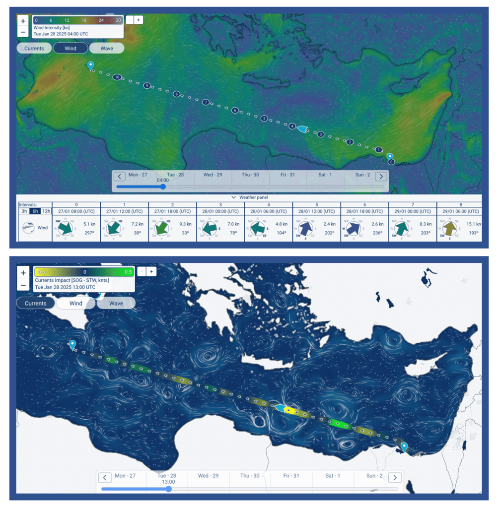
Figure 1: Example of the forecasted weather (upper panel) and surface current impacts (lower panel) for a journey from Malta to Gibraltar.
Using conventional Weather Routing System, ships will avoid major storms and bad sea state during trans-oceanic voyages. The aim of The Ocean Bulletin is to focus on short-sea shipping, to look at a smaller scale to position the ship correctly on the right-side of the oceanic currents. We therefore propose, for all the registered users, the possibility to compute a few optimized routes from Port to Port.
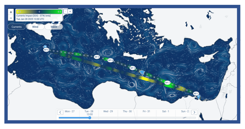
Figure 2: Example of the optimal route for a journey from Malta to Gibraltar.
Thanks to The Ocean Bulletin
short-term optimal routing can be used today to all ships
for their transits or regular voyages across the Mediterranean Sea.