Oceanographic expertise
The technologies developed by Amphitrite are based on the extensive oceanographic and meteorological expertise of its founders. Our origins tracks back to the French national research center CNRS and the Laboratoire de Météorologie Dynamique at the Ecole Polytechnique, where we have developed, in the last few years, numerous tools, based on advance AI computer vision, to characterize the physical and dynamic properties of the ocean in real time. Amphitrite has the exclusive license of a CNRS patent resulting from the pioneering research work of its founders.

SATELLITE DATA FUSION
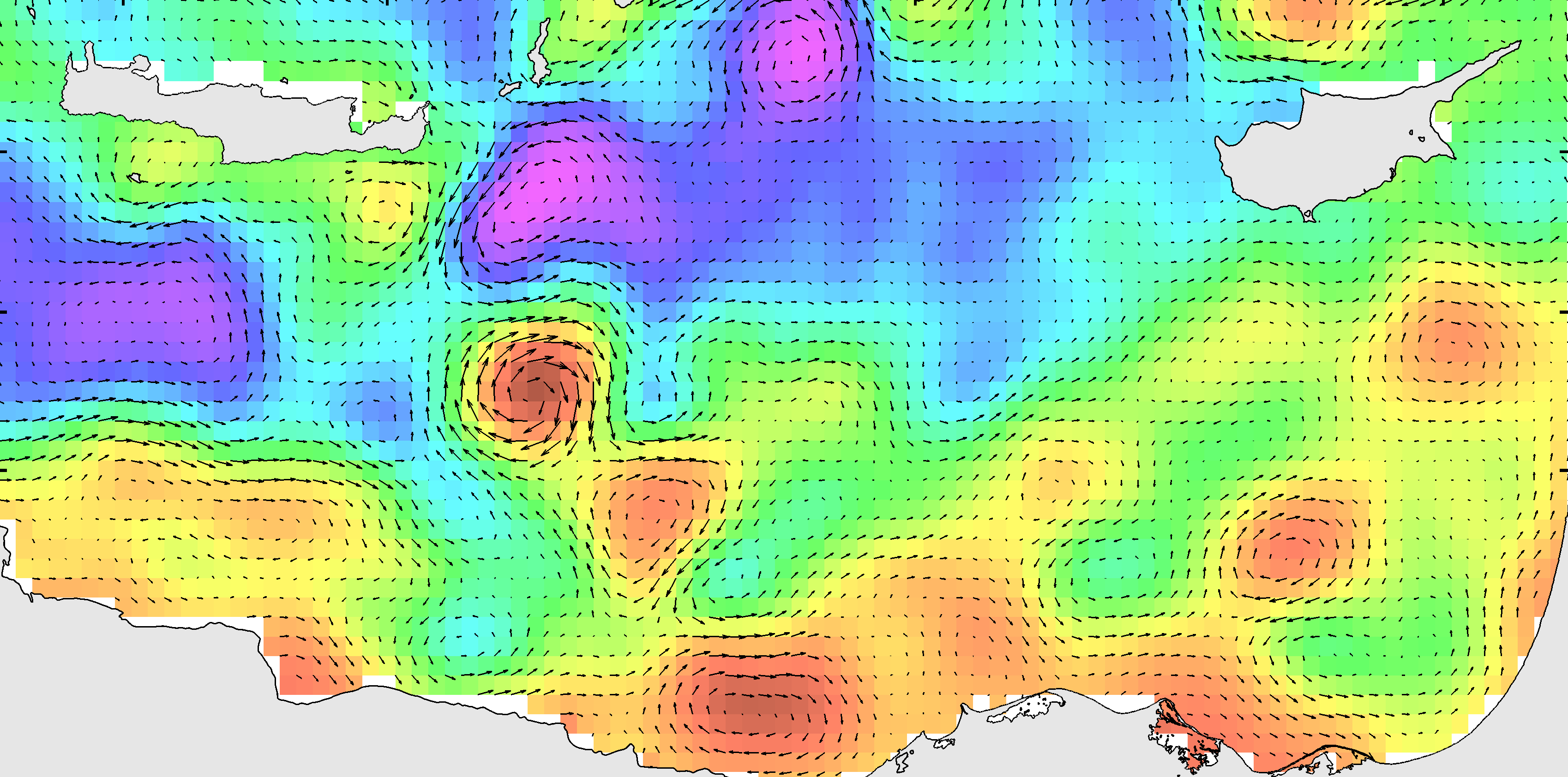
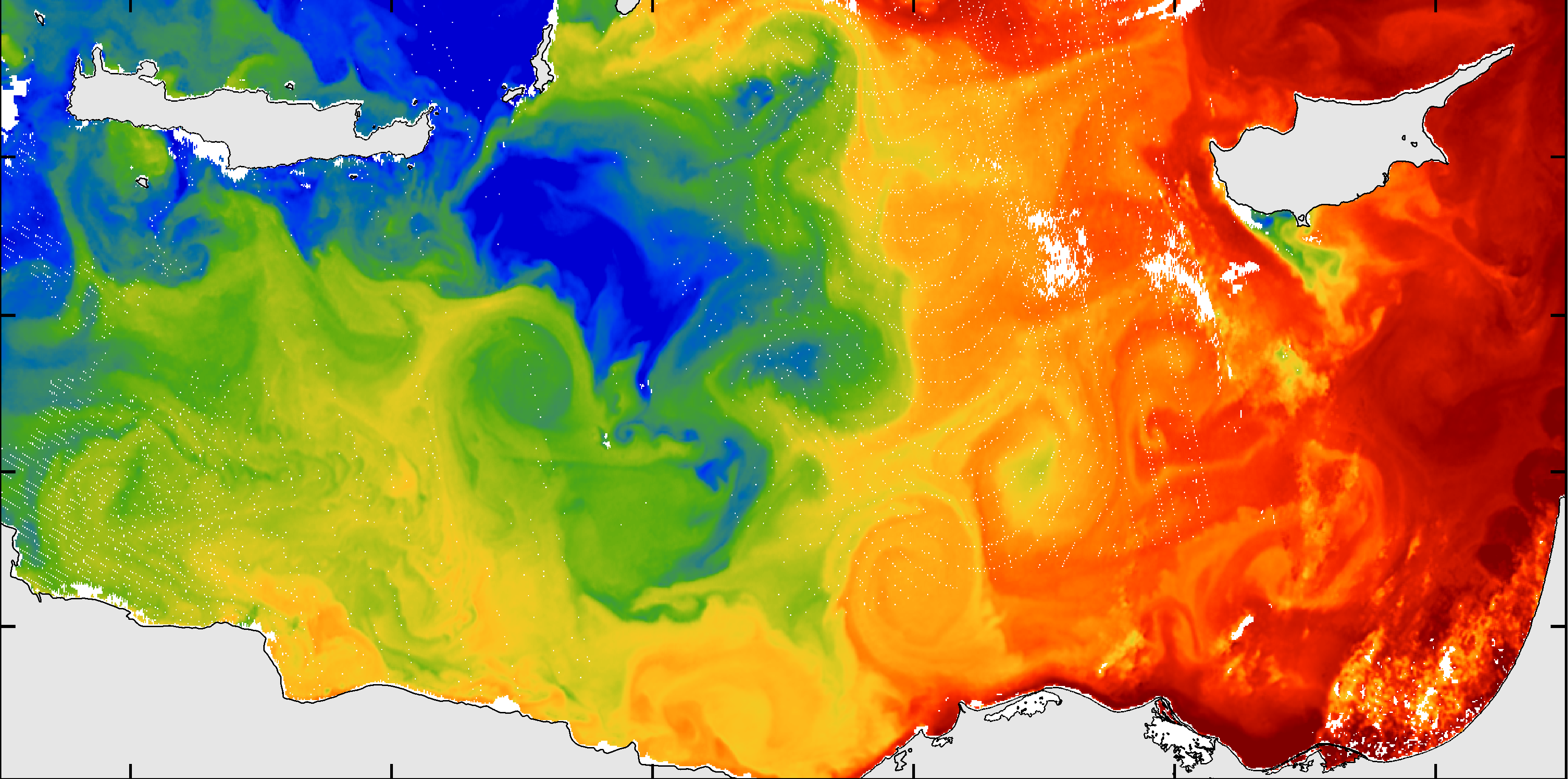
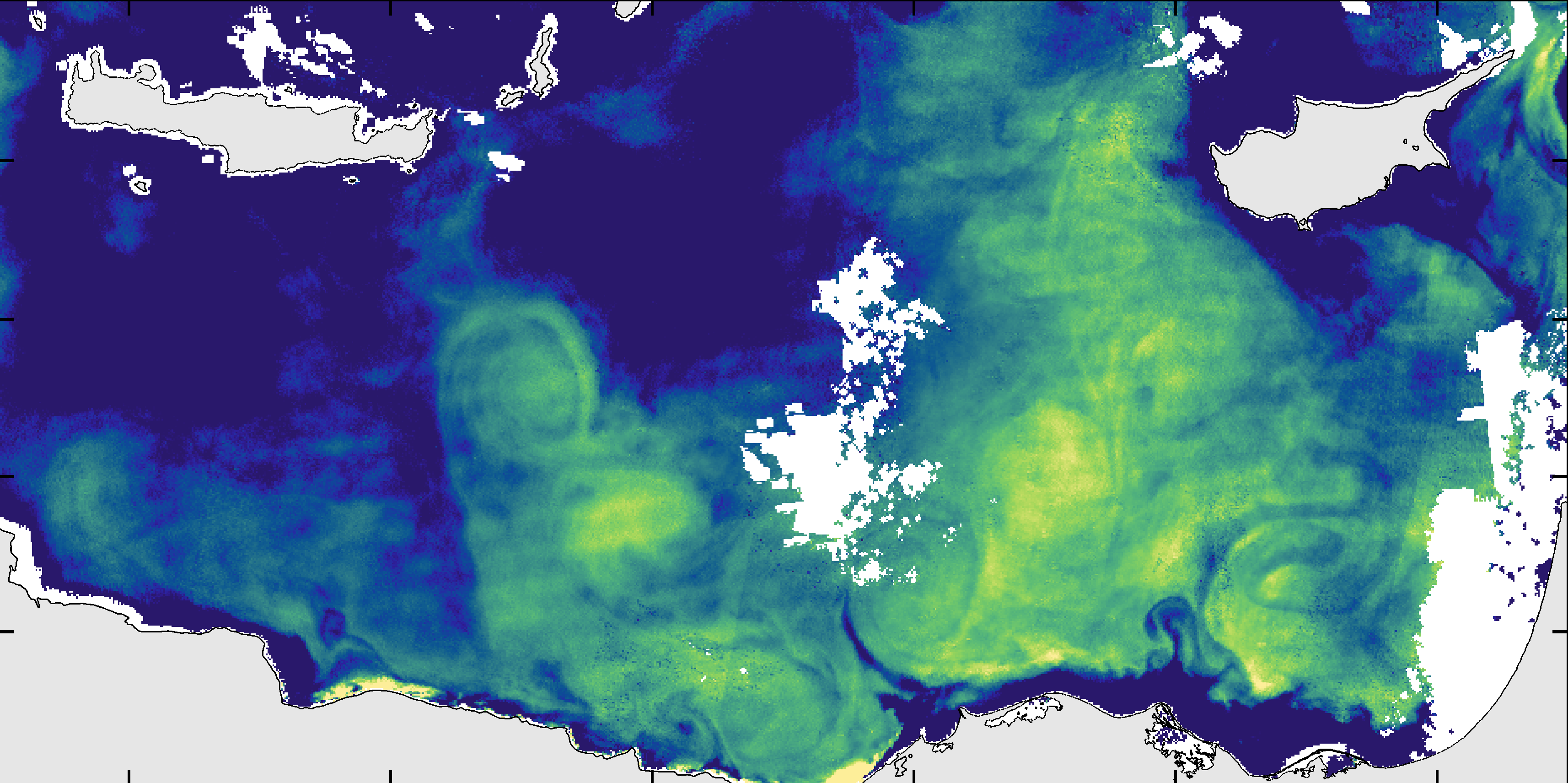
Oceanography has gone from a state of data scarcity to one of extreme abundance. The deployment of numerous ocean observing satellites provides real-time observations over very large areas that can cover almost all the oceans. A very small amount of these data are actually used. The challenge today is to make the best use of this ocean of data.
DATA FUSION
OF SEVERAL SENSORS FROM DIFFERENT SATELLITE
IS AT THE HEART OF OUR INNOVATION
It is only very recently that we are starting to merge different physical variables to extract new information or increase the reliability and accuracy of data. The side images were taken at the same location the same day. It show that various eddy structures have a signature both on altimetry data (top), sea surface temperature (middle) or water color (bottom) images. Thanks to advanced AI computer vision we can fuse these different variables and compensate for the errors specific to each sensor. Hence, we strongly improve the reliability and also transfer the geometrical patterns visible on high-resolution visible image to the low-resolution altimetry map to increases the resolution of the velocity fields. Moreover, if we add in-situ measurements we can also estimate the subsurface water masses, especially in the heart of the eddies.
HIGH RESOLUTION
SURFACE CURRENTS
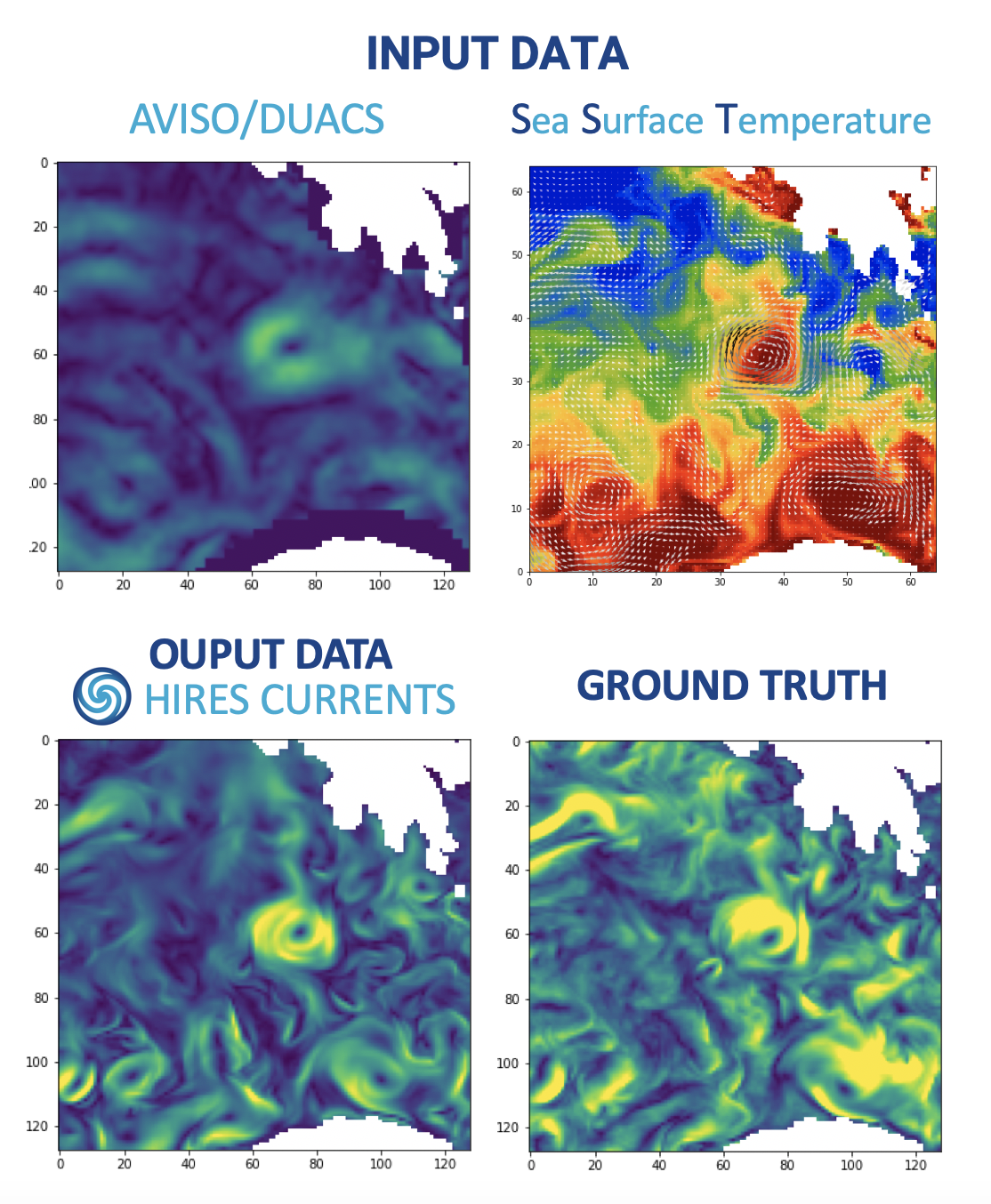
The fusion of AVISO/DUACS altimetry data with very high-resolution infrared images corresponding to the sea surface temperature allows for the reconstruction of high-resolution and reliable maps of ocean surface currents. To this end, we employ a Super Resolution pipeline through an encoder-decoder network with a multi-modal input and a multi-task output setup.
We can use the outputs of a numerical model of the ocean and synthetic reconstruction of satellite data sets to test our neural network. The images below show the input data and the output of our neural network: the high-resolution surface currents. The latter is compared to the reference velocity field, i.e. the ground truth.
OCEANIC EDDIES DETECTION
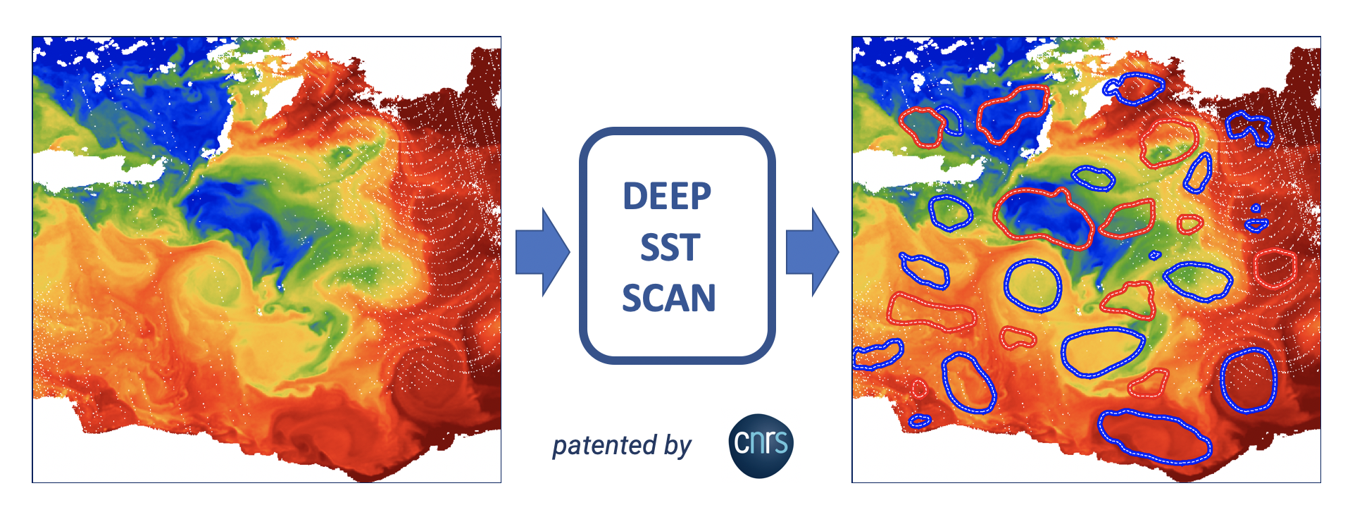
During oceanographic campaigns, it is the high-resolution visible images, in particular the Sea Surface Temperature, that allow to identify with a high accuracy the meanders of oceanic current or the exact position of eddies. These visible patterns of a complex dynamic flow are usually analyzed, on board, by a human expert. Inspired by the recent developments of AI computer vision, successfully used in medical imaging, we develop a deep learning procedure and a convolutional neural network architecture adapted to the analysis of Sea Surface Temperature images. The image below shows the dynamical eddy contours corresponding to the maximum speed of each eddy detected on SST image.
