Operational numerical models
are not always reliable
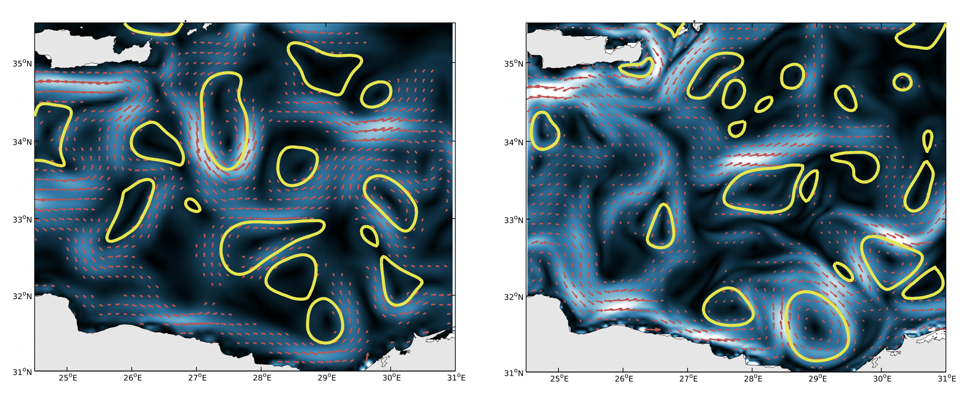
Surface currents (red arrows) and eddies (yellow contours) for two different models in the Mediterranean Sea.
This couple of images show two distinct operational forecasts of surface currents in the same area for the same day. The differences between the locations of eddies and the currents meanders for these two forecasts reveal a lack of reliability at regional scales. Yet, the reliability of ocean data is essential to make the right decisions at sea.
The solutions
fusion of satellites data
AVISO/DUACS altimetry products
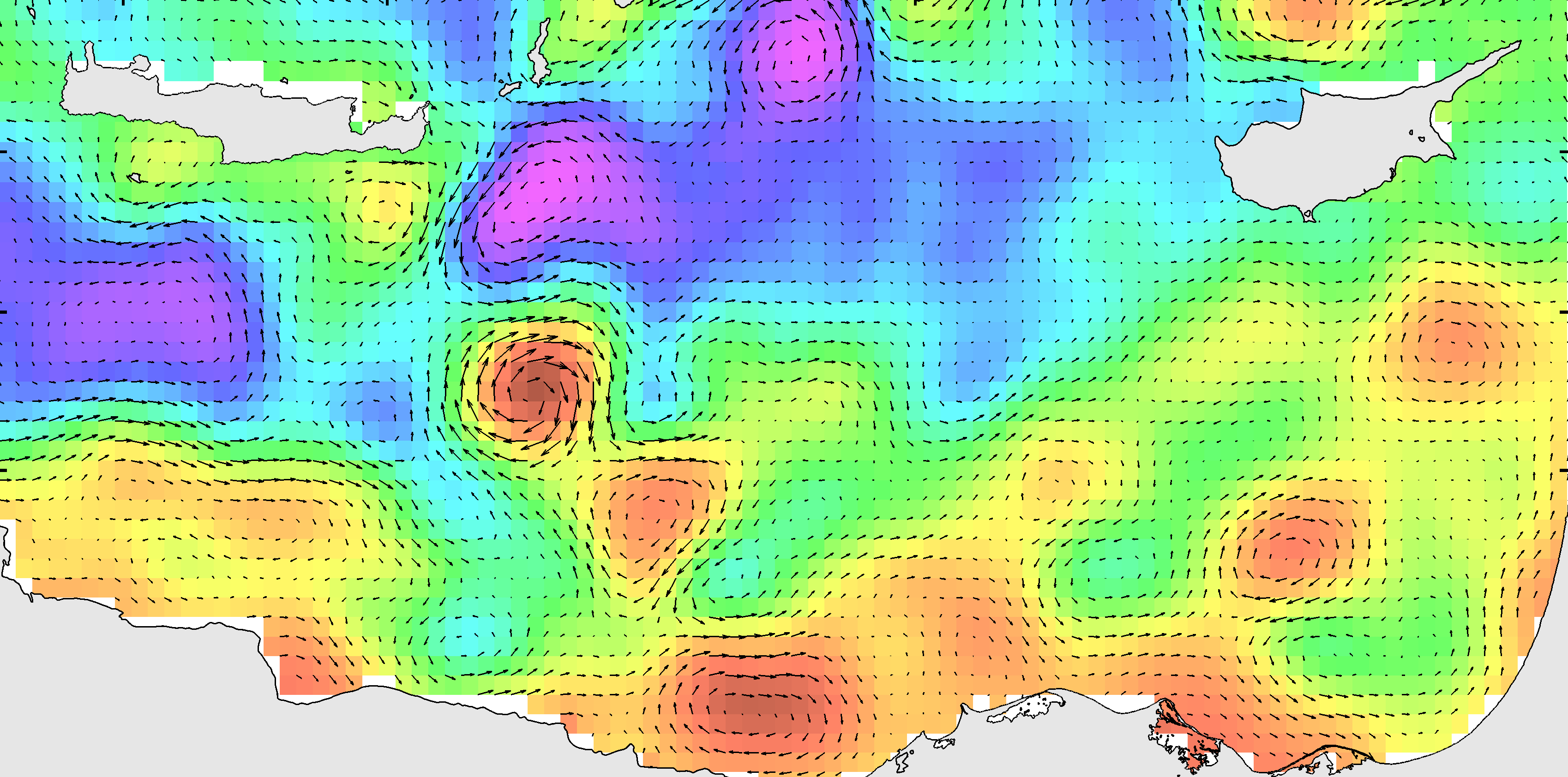
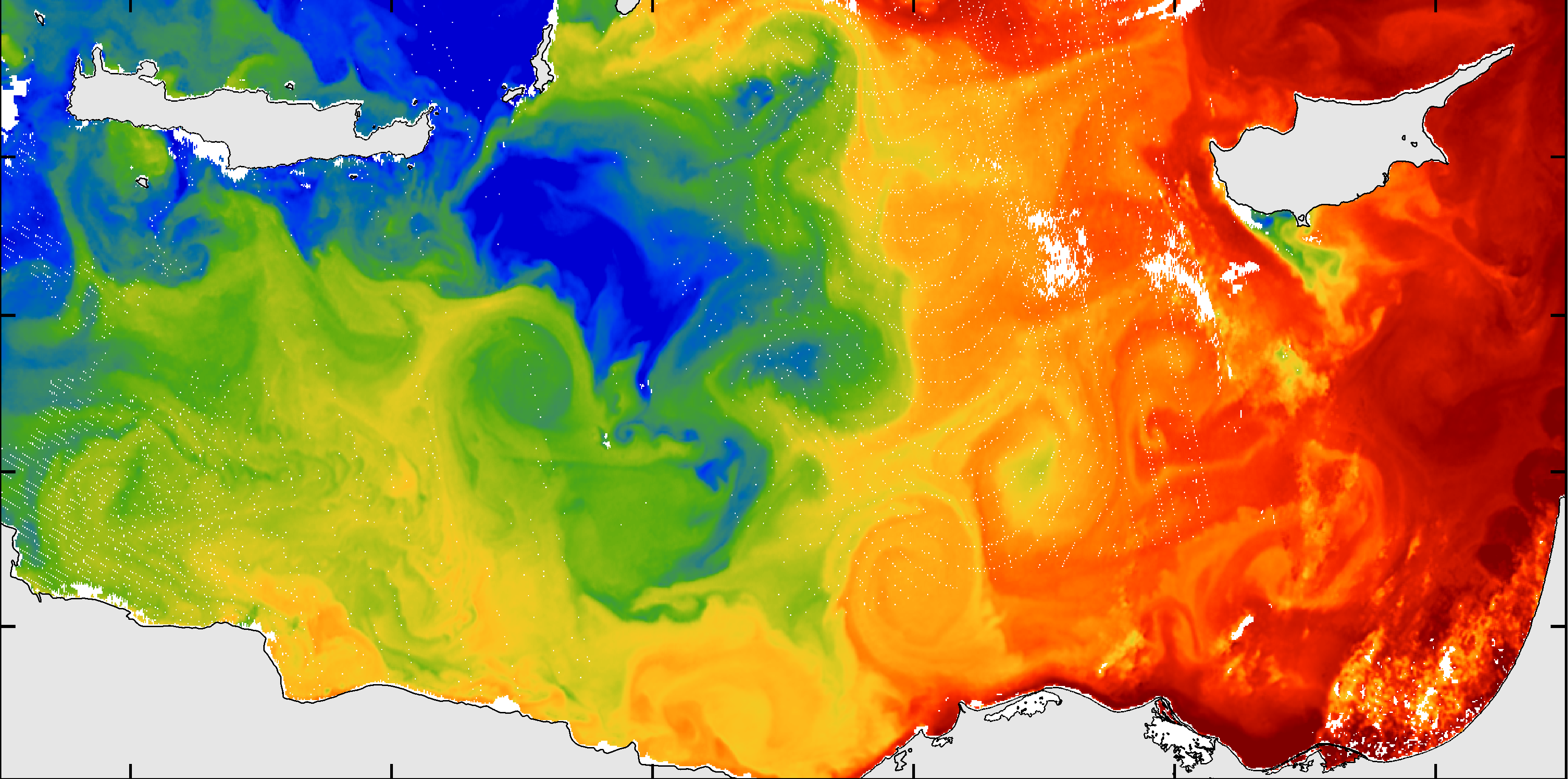
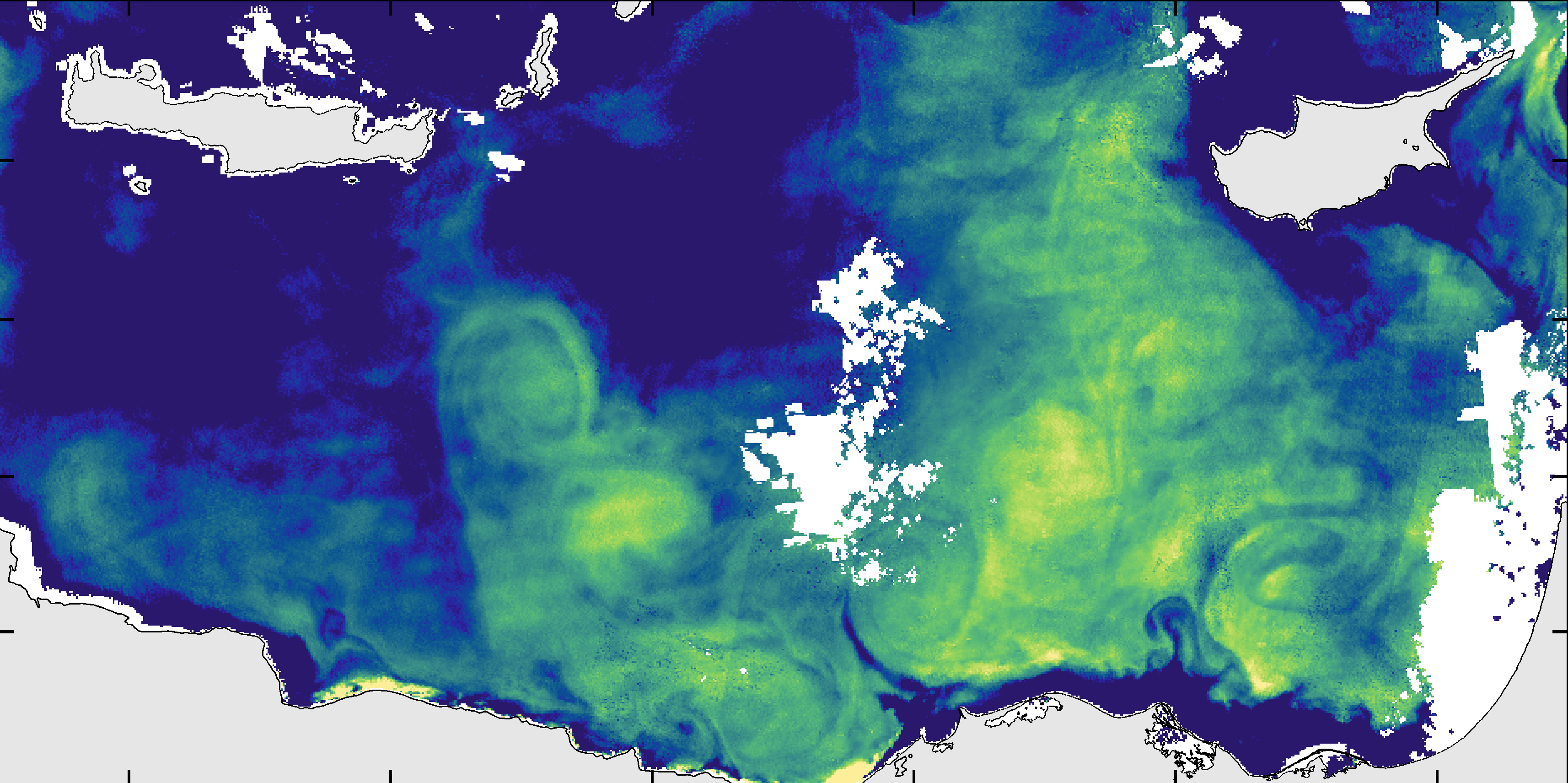
The fusion of standard altimetry data set, which includes geostrophic currents (upper left panel) with Sea Surface Temperature (middle left panel) and Ocean Color Reflectance (lower left panel) provides a high level of reliability. When two distinct satellite informations are coherent the same day at the same location the reliability of these remote sensing observations becomes very high. The biases or the errors of each observable are thus filtered out.
Sea Surface Temperature
The remote sensing observations
can overcome the accuracy
of numerical models
Ocean Color Reflectance
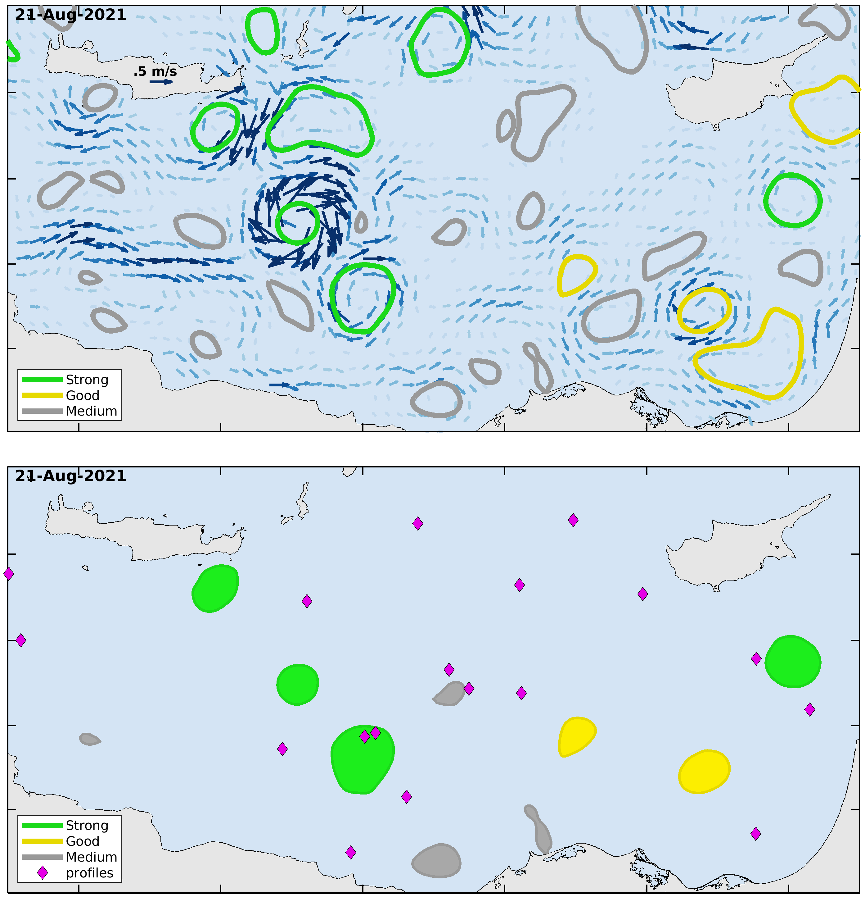
For all the data we produce we are able to provide a reliability index at three levels: strong, good and medium. The level of reliability depends on the overlapping of coherent structures which are detected on the different data-sets. The spatial resolution of visible images is very high and when the cloud cover does not exceed 50%, we are able to identify small structures down to 15-10 km.
Daily surface currents
We produce, for instance, daily surface currents with a local reliability index in targeted areas. The side image shows an example in the Mediterranean Sea where the reliability of operational numerical models are known to be relatively low.
Validated eddies
We can detect, from satellite observations, a large data set of oceanic eddies with an high accuracy on their locations, shapes and intensities. Such data-sets are very useful for model validation.
Acoustic impacts
By combining various in-situ datas, especially argo floats, we can estimate the sub-surface structure of oceanic eddies and identify those who have a potential acoustic impact.
Ocean Color Reflectance


