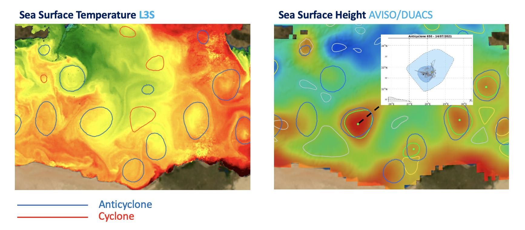
MONITORING OF OCEANIC EDDIES
Reliable and precise detection of ocean eddies can significantly improve the monitoring of the ocean surface and subsurface dynamics, besides the characterization of local hydrographical and biological properties, or the concentration of pelagic species. Indeed, long-lived oceanic eddies strongly modify the ocean background both at the surface and at depth. The AMEDA algorithm, developed by our team, is now widely used by researchers, from various countries, to detect, characterize and track the trajectories of oceanic eddies either on standard altimetry products or numerical models.
The co-localisation of in-situ measurements, especially those of automatic argo profilers, with remote-sensing observations allows us to estimate part of the sub-surface structure of the ocean. Thanks to this methodology we were able to build a unique data-base of oceanic eddies: the DYNED-Atlas. This data-base characterizes the dynamical properties and the sub-surface structure of long-lived eddies for more than 18 years in two specific areas: the Mediterranean Sea and the Arabian Sea. This achievement was made possible due to a close collaboration of research laboratories with the company CLS and the Oceanography unit of the French Navy (Shom).
A NEW SOLUTION DEEP-EDDY-SCAN


